Thursday, August 25, 2011

Moosehead Lake...Greenville, Maine

What a gorgeous area.  When we first went there the last of June, on a birding trip to Pittston Farm, we vowed to return to do some of the other things there are to do in this area.  Today was a return visit to cruise Moosehead Lake on the famous Katahdin steamboat which now runs on diesel.


The boat is anchored right next to the museum where you purchase your tickets.

I have to make a correction on an earlier blog.  This lake is the SECOND largest fresh water lake east of the Mississippi with Florida having the first.  However, it may be the deepest at 254'.


Click on the picture to enlarge for reading.

The lake holds 80 islands, has 400 miles of coastline, and is 75,000 acres in size. 


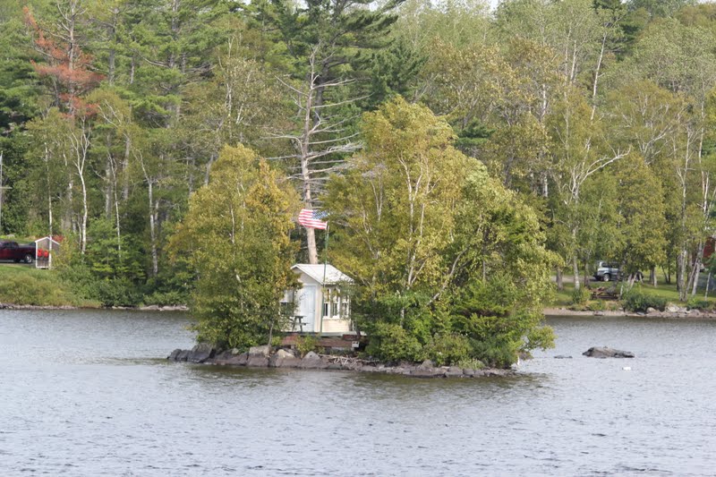
This is the smallest island.  Most of them are privately owned with houses on them.  The tall snag in this picture had a Bald Eagle perched on it.

Some of the mountains viewed from the cruise.


This is Big Spencer Mountain where the Bichnell's Thrush can be found.  Want to go for a hike?


This is Mount Kineo behind the small island. 


There is a nice hike to the top where you can climb up a fire tower for a 360 degree view.

Being that it is a 4 hour drive for us to get there and the cruise leaves at 12:30, there was no time left to do that hike.  There are lots of other hikes with things to do soooooo, that means another trip.  Darn the luck.

How about a seaplane ride?  That's there too! 


We had clam chowder on the boat for a little snack.  After we disembarked, 3 hours later, we ate at this place.


BURGERS.....BATHROOM.......BEER.  Named the Green Frog.

On our journey up to the lake, we came upon this covered bridge.


The original one was built in 1830 and rebuilt in 1990 because of a massive flood of the Piscataquis River.  It is the Low's Bridge.

On our way back, the Appalachian Trail crossed the road.  At this point, the hikers have only 112 miles to go to Mount Katahdin, the highest point in Maine, to finish their long trek that started in Georgia.

We had planned to spend the night and do some of the hikes, but with the threat of rain, we drove back.


Sunday, August 21, 2011

Machias Blueberry Festival

Machias is the county seat of Washington County.  It is the second largest community in the county, second to Calais, with a population of 2,353.

It's a pretty town with the Machias River running through it.

Each year in August, they have this Blueberry Festival.


This is where all the action centers.  In front of this beautiful church.


There are mannnnny vendors selling everything from blueberry jam to burl bowls.


There is a blueberry pie eating contest for all ages, this happens to be the first group.  They end up with most of the pie on their faces and clothing, but it is really funny to watch.

This is a big reason why we go every year.


They have a huge library sale.  Hardbacks are $1.00.
Wallace is paying for our purchase.  Our oldest son, Wally, collects Stephen King books.  Plus we stock up for ourselves to keep us in books for a while.  We hit the jackpot.  We make sure we get there early.  This year, they had the books in alphabetical order..WOW!
We headed straight for the K's first. 

Another thing we like is the food!!! 


You can see a few doughboys in the picture.


We certainly enjoyed the funnel cake with lots of powdered sugar.


Monday, August 15, 2011

A Little About Glaciers

Something I have found interesting as of late are glaciers and the effects they played upon the land.  So here is a little bit to share with you of what I have learned about them.

While we were volunteering at Ottawa NWR in Ohio, we took a trip over to Kelly's Island to see Glacial Grooves State Memorial.


These are some of the best examples of Glacial scarring we have seen.

During the last Ice Age 25,000 years ago, the ice sheet covered all of Maine to a depth of 1.5 miles.  The weight pushed the Earth's crust downward over 500'.

With rising global temperatures, the southern margin of the ice sheet began to retreat across the Gulf of Maine.

Just after the glacial retreat much of Maine was a treeless tundra that housed large animals, such as wooly mammoths.  Today, Maine is the most forested state in the U.S.

Maine's diverse geologic landscape was created by these vast sheets of glacial ice melting and moving in a south easterly direction leaving behind moraines, deltas, and eskers.  This North American continental glacier is called the Laurentide Ice Sheet.

Cadillac Mountain, in Acadia N.P., was possibly the first to emerge from the ice about 17,000 years ago.  It was shaped by glacial abrasion and quarrying beneath the ice sheet.  There are many places where you can see these glacial grooves.

The term moraine is sediment deposited directly from a glacier.  It is a random mixture of rock and mineral fragments ranging from clay to boulder size.  This material is also called till.

Eskers are ridges of sand and gravel deposited in tunnels that formed at the bottom of the ice sheet.  During the ice retreat, the tunnels were clogged with sediment.  These tunnel fillings that were left behind are called esker ridges.

Deltas are large, flat-topped bodies of sand and gravel that washed into the sea at the edge of the glacier.  The sand and gravel were deposited in such large quantities that they eventually built up to the ocean surface and became full-fledged deltas.  The sandy soils on eskers, deltas, and moraines are favorable for growing blueberries.

From Acadia N.P. to the east south of Calais is an interesting trail of Maines Ice Age where there are 46 stops to see and learn about the last Ice Age.


We had this picture on before, but this is an example of a moraine and what the glaciers left behind.  A sight like this is not hard to find, boulders left scattered around here in the great state of Maine. 

Wednesday, August 10, 2011

A Tour of Calais, Maine


Calais (pronounced callous) Maine is the largest community of 44 in the county.  It was incorporated as a town in 1809 and as a city in 1851.  Moosehorn NWR is 7 miles north of Calais.

When at Santa Ana NWR, we can look across into another country.  While at Moosehorn NWR we can look into another country.  However venturing into Canada, we don't have the same trepidation.


This is entering town on US 1, which follows the St. Croix River that separates the US from Canada.  Turning left, you would be going into Canada via the bridge.  Going straight would take you to the river where you can access a walking path that parallels the river.


You can see in the background the bridge that crosses into St. Stephen where the Ganong Chocolate Factory is located.  Calais is kept alive with the Canadians coming here to shop. 

Along with the lumber industry, Calais also developed as a ship building center and became a boom town.  Many of the beautiful old homes were owned by the people engaged in these businesses.  You can see from the picture above where some of the old wharves used to be.


This is the oldest house in Calais built in 1805.  It is known as the Holmes Cottage/Museum.


This is the library which was built in 1892.

Every Tuesday evening in the summer, there is live entertainment on the Village Green...no charge.


There is a very nice visitor center which is run by the Passamaquoddy Indian Tribe.  There is free wi-fi, and downstairs are displays where you can learn more about the tribe.


This is a display of some of the hand made sweet grass baskets.  The picture below is right across from the Village Green, depicting the main drag.


If you were to go straight, that would take you north out of town.  But we are turning left on US 1 that will take us to the Red Beach area and along that row of red buildings in the picture above.  I just have to throw in another picture here of a close-up of the building on the left.


Dr. Thomson's Sarsaparilla....cures when others fail!!!
Hum, I wonder if there is any truth to that??

Now, back to the Red Beach area of town.  It's called Red Beach because of the red granite that used to be quarried here.

On this island was where the first European settlement North of Florida was established in 1604.  It lies in the middle of the St. Croix River making it an International Historic Site.  They found the Passamaquoddy tribe to be friendly and willing to trade.  This picture is taken during low tide.


The settlers, led by Pierre Dugua and Samuel De Champlain, had a disastrous winter here during which many of the settlers died.  There was a total of 78 men,  35 of whom died.  They became trapped on the island because of the severe winter, freezing the water and then the tides would break up the ice, making it impossible to cross to the mainland.  They ran out of fresh water and food.


The island was named by Dugua because the intersection of tributaries upriver appeared to form a cross.

Passamaquoddy means People of the Dawn.

I left out one of the mottos in our last blog:
State Motto:  Dirigo....I lead!!

Hope you enjoyed your tour of Calais.  If you pronounce it calay, they know your from away.


Sunday, August 7, 2011

Facts about Maine

State Capital:  Augusta
State Gemstone:  Tourmaline
State Insect:  Honeybee
State Bird:  Chickadee
State Fish:  Landlocked Salmon
State Tree:  White Pine
State Herb:  Wintergreen
State Soft Drink:  Moxie
State Animal:  Moose

Maine is recognized as one of the most healthful states in the nation with summer temps averaging 70 degrees.

It is about as big as the other five New England states combined with 16 counties, with one of them being so big (Aroostook) that it covers an area greater than the combined size of Connecticut and Rhode Island.

With 6,000 lakes and ponds, 32,000 miles of rivers and streams, 17 million acres of forestland, over 5,000 miles of coastline, and 2,000 islands.

It has one mountain which is approximately one mile high, Mount Katahdin where the Appalachian Trail has its northern end or start.

It has 65 lighthouses, including Portland Head Light commissioned by George Washington which is on the quarter for the state coin.

It is America's largest wild blueberry growing state, raising 98 % of the lowbush blueberries in the U.S.

Known for its shellfish, it averages nearly 40 million pounds of lobster harvested annually.

Next blog I will  be sharing with you will be about the little town of Calais, the closest town to the refuge.

Friday, August 5, 2011

Continuation of Sign Work

Our day was spent at the Edmunds Division working on signs of one kind or another.


The box I'm working on holds our hikers sign in sheet.  I also keep the big kiosk up to date.  This I do while Wallace is getting the trail counter total. 


I gutted the inside, cleaned out the bugs, made the sign on the outside that you see, and put in some pencils and new, clean sign in sheets.  Hikers really do sign in.


This is the small parking area where one of  the wilderness trails starts.

We installed more of the wilderness boundary signs with two of the corners now fixed.


Some of the tools we use:  Post Driver which weighs about 30 lbs. and a bar which is heavy enough.  I find time to do a little weight work-out.  Wallace gets a good laugh out of that!  Hey, it does the job!


Sometimes we have to get a little creative.  No ladder, well we just back up the truck to reach some of the older posts to put on newer signs.  We think maybe giants put these older posts in as they left them so high.

Tuesday, August 2, 2011

HAPPY BIRTHDAY TO CAROLYN

August lst...Carolyn's birthday.  My day.  What would I like to do?  Well, we start off by having blueberry pancakes with real Maine maple syrup.  The berries were picked here on the refuge as they allow 2 quarts a day per person, no rake, only handpicked.  Next was my haircut.


I haven't been to a beautyshop going on 9 years now.  Think of all the money I've saved.

The outing today will be crossing into Canada.  We take route 1 north to Houlton and cross there.


Our destination is Hartland, New Brunswick.  But first, here is my birthday card from Wallace.


This was a sign in sheet at an overlook.  Very original wouldn't you say?  The first birthday call was from my sister Murriel.  It was pretty ironic, as we said our goodbyes and I closed up my phone, the time was 8:43.  The month and year of my birth.  Now you know how old I am.  BIG DEAL!  The next call was from my granddaughter, Lindsey, who is 6 years old, singing Happy Birthday with a cha cha cha.  She has a lovely voice and can carry a tune.  There were various other calls but I won't elaborate.

Now on to our trip.


Yes, we are going to visit the WORLD'S longest covered bridge.  It is 1282' long, built in 1901 and covered in 1922.
 

Can you see the entrance to the bridge?  We not only drove across, but we walked it as well.  We discovered they accept graffiti, so I just had to put our names there.


Down below us is the mighty Saint John River that eventually empties into the Bay of Fundy.


One last shot as we crossed it again on leaving.

On to the Covered Bridge Potato Chip factory for a tour.  It is an old fashioned kettle chip company that controls the whole process from the time the seed potatoes go into the ground to bagging them up for sale.  We are in the heart of potato country!!!


Remember, you can click on the picture to enlarge so you can read about the history of the potato.  The tour was free because of equipment failure, but I would not recommend paying for this tour.  My shoes were slipping and sliding on the greasy floor.


Homeward bound with our chips in hand and they were very good.  Look who is grabbing for the bag.
We both enjoyed my birthday!!!